Weather
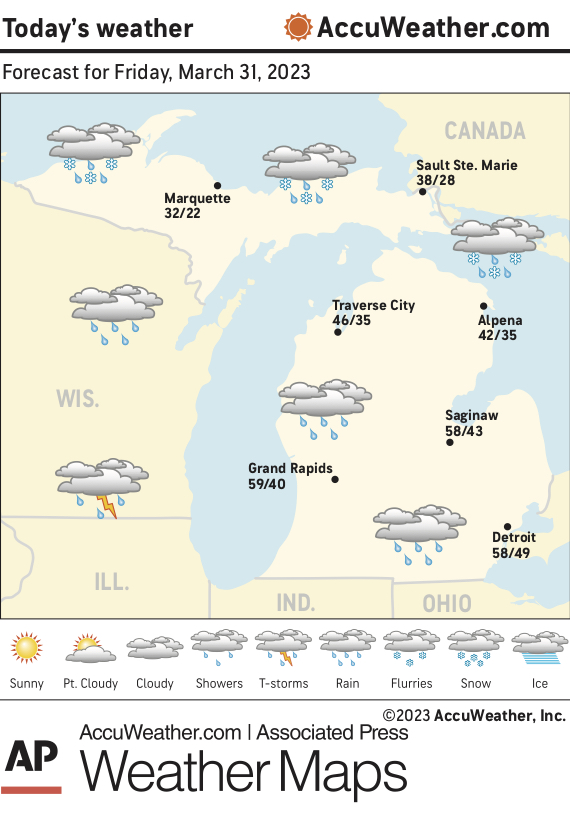
Marquette and vicinity: Today, rain, snow and sleet, possibly mixed with freezing rain before 4 p.m., then sleet, possibly mixed with rain and snow. High near 35. Northeast wind 10 to 15 mph. Chance of precipitation is 80%. Little or no ice accumulation expected. New snow and sleet accumulation of around an inch possible. Tonight, snow and sleet, possibly mixed with rain before 11 p.m., then snow, possibly mixed with sleet between 11 p.m. and 2 a.m., then snow likely after 2 a.m. The snow could be heavy at times. Widespread blowing snow, mainly after 2 a.m. Low around 21. Windy, with a northeast wind 15 to 20 mph increasing to 25 to 30 mph after midnight. Winds could gust as high as 45 mph. Chance of precipitation is 80%. New snow and sleet accumulation of 6 to 9 inches possible.
Extended forecast:
Saturday, snow likely, mainly before 8 a.m. The snow could be heavy at times. Widespread blowing snow, mainly before 8 a.m. Cloudy, then gradually becoming mostly sunny, with a high near 26. Windy, with a north wind 20 to 30 mph, with gusts as high as 45 mph. Chance of precipitation is 60%.
Saturday night, mostly clear, with a low around 14.
Sunday, a 50 percent chance of snow. Partly sunny, with a high near 40.
Sunday night, a chance of rain and snow before 2 a.m. Mostly cloudy, with a low around 31.
Monday, partly sunny, with a high near 42.
Monday night, mostly cloudy, with a low around 25.
Tuesday, a chance of snow. Mostly cloudy, with a high near 35.
Tuesday night, snow. Mostly cloudy, with a low around 28.
Wednesday, rain and snow likely. Mostly cloudy, with a high near 45. Breezy.
Lake Superior: Gale warning in effect from this evening through Saturday afternoon. Today, northeast wind 15 to 25 knots. Snow likely possibly mixed with rain in the morning, then sleet possibly mixed with rain in the afternoon. Waves building to 4 to 7 feet occasionally to 9 feet. Tonight, northeast wind up to 30 knots increasing to gales to 35 knots after midnight. Storm force gusts up to 49 knots. Rain and snow possibly mixed with sleet in the evening, then snow likely after midnight. Waves building to 15 to 20 feet occasionally to 25 feet.
Temperatures: The average temperature Thursday at the National Weather Service office in Negaunee Township was 22 degrees, 8 degrees/below normal. The high Thursday was 38 degrees and the overnight low was 5 degrees.
Precipitation: Thursday, none. Year to date, 10.33 inches. Normal to date, 7:15 inches.
Snowfall: Thursday, none. Season to date, 213.5 inches. Normal to date, 17.71 inches.
Sunset: 8:18 this evening. Sunrise: 7:30 a.m. Saturday