High lake levels to continue through summer
cbrown@miningjournal.net

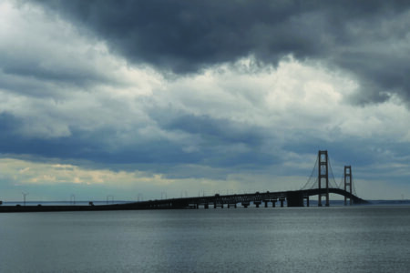
Deanna Apps of the U.S. Army Corps of Engineers speaks about the current high water levels on Lake Superior at a presentation given by the U.S. Army Corps of Engineers April 16 at the Marquette Township Community Room. (Journal photo by Cecilia Brown)
MARQUETTE — Lake Superior’s water levels are currently above average and may even reach record highs during the summer, according to a presentation held April 16 by the U.S. Army Corps of Engineers and Michigan Sea Grant at the Marquette Township Community Room.
Lake Superior water levels have been above average each month this year, and in March the lake was about a foot higher than average.
“The monthly mean March level was 6 inches above its level of 2017, it was 12 inches above its long-term average level for March and importantly, it was just 3 inches below the record high for March, so really, it is quite close to that record high,” said Lauren Fry, civil engineer at the U.S. Army Corps of Engineers, Detroit District.
In some forecast scenarios, Lake Superior could reach record high levels in June, Fry said. However, the most probable forecast is that lake levels will continue to be above average during June, but not hit the record high levels reached in the 1980s.
It’s important to consider the historical context and factors contributing to lake-level variation, as Lake Superior hit record low levels in 2007, but is now nearing record highs.
Water levels are dictated by the net basin supply, which is the sum of water coming into the lake, minus the water leaving the lake over a period of time. Precipitation, runoff and other bodies of water flowing into the lake contribute to water levels, while evaporation and outflows from the lake remove water. In an average year, the water coming into the lake is roughly equal to the water lost from the lake, which causes water levels to remain the same.
For most of the past five years, Lake Superior has had an above-average net basin supply, meaning more water has entered the lake than left it over this time.
The unusually wet years of 2013, 2014 and 2017 contributed to high water levels.
“This two-year period between 2013 and 2014, that equated into a 2-foot rise on Lake Superior during that two-year time frame … It really brought levels from a really low water period that you can see extended for a good decade or so, and then, in those two years, we’ve gone from near record lows to above-average water levels,” said Deanna Apps of the U.S. Army Corps of Engineers.
Water levels were over 603 feet in October 2017, the peak monthly average for that year, and almost a foot above the long-term average for the month of October.
All aspects of water supply were shifted toward more water going in the lake than coming out of the lake in 2017, with precipitation, runoff from snowmelt and inflow all above average.
Even though evaporation and outflow through the St. Mary’s River were both above average in 2017, it was not enough to compensate for the increased amount of water coming into the lake, which led to a rise in lake levels.
Apps and Fry noted that while month-to-month net basin supply is highly variable and difficult to predict, the Corps has forecasting tools that allow it to model future water levels that could result from a number of different scenarios.
“We take scenarios of net basin supply and we start at our current levels and see what the possibilities are,” Fry said.
The most likely scenario for 2018 is that water levels will remain above average, but not hit record highs.
“Our projected levels … are showing that the lake will be 7 to 10 inches above the long-term average over the next six months, it’ll be 4 to 6 inches below the record high water levels and it will be below last year’s levels by July,” Fry said.
However, there is a wide range of uncertainty in the water level outlook, and there is still a possibility of hitting record highs in summer 2018, Fry said.
Due to the range of uncertainty in the water level outlook, officials said it’s important to stay up-to-date on this information, as increasing lake levels — whether they break the record or not — can affect the impact of storms on coastal areas.
“These big storms that we’ve had, combined with the higher lakes have caused a lot of shoreline property owners a great deal of consternation, as far as their property is concerned and wanting to do something to reinforce their properties … We ask them to contact our office first before they do any work,” said Bob Deroche, project manager at U.S. Army Corps of Engineers, Detroit District, Marquette Field Office. “We are very responsive with the field office here in Marquette. We can usually make it out to a site within a couple days, certainly local sites, if there’s an eminent danger of people losing big hunks of property or if integrity of structures is in question, we can respond very quickly.”
Deroche said most permit applications for this type of work don’t have fees.
Further advice was offered by Helana Nelson of the Michigan Department of Environmental Quality Water Resources Division.
“Landowners wanting to install shoreline protection on their properties should contact the DEQ Upper Peninsula District Office in Marquette at 906-228-4853 to determine whether they need a permit and discuss ways to protect their property while minimizing potential adverse environmental effects,” Nelson said. “Every situation is different, so we encourage anyone planning a shore protection project to involve us early on in the process so that we can help evaluate possible options based on specific site conditions. We understand that some property owners have very real concerns about structures being threatened by erosion and are always willing to work with people to help them protect those structures as soon as possible. A permit may be required from both the DEQ and the U.S. Army Corps of Engineers, but owners only need to submit one application which gets reviewed by both agencies. That joint permit application and additional information is available at www.mi.gov/jointpermit.”
Fry and Apps noted that people can stay informed about current, historic and predicted water levels on the Great Lakes by using the Corps forecast tools, available at: http://www.lre.usace.army.mil/Missions/Great-Lakes-Information/Great-Lakes-Water-Levels/
Front Page News

Arrest made in Chippewa County drug overdose death

MSHS, NMU alumn celebrates ‘KPop Demon Hunters’ wins
Opponents worry over tunnel construction as Line 5 report released

Confirmed details in child’s death released

Superior Extrusion achieves milestone