
Deep freeze hits area
State offices, local schools closed; U.S. Postal Service suspends delivery today
Trending
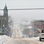
MARQUETTE -- In light of the bitterly cold air and wind chills falling far below zero, all Michigan state offices are closed today, and the U.S. Postal Service has suspended deliveries for the day. This follows Gov. Gretchen Whitmer's declaration of a state of emergency Tuesday due to the frigid conditions across the state.
Schools throughout the Upper Peninsula have also closed today, from Northern Michigan University and Marquette Area Public Schools in Marquette, to Munising Public Schools in Alger County and Houghton-Portage Township Schools in the Keweenaw. Mail will not be delivered today to zip codes starting with 486-491 or 493-499, according to the U.S. Postal Service.
The lowest wind chill readings in Marquette County this morning were predicted to reach 30 to 40 degrees below zero, according to the National Weather Service office in Negaunee Township.
"The wind chills have been as low as 30 below zero right in the immediate Marquette area and most of Marquette County," said Matt Zika, a meteorologist at the office.
On Thursday morning, wind chills could fall to 45 below zero in Marquette County, according to the NWS forecast.
Due to this, a wind chill warning is in effect through noon Thursday and officials are urging residents to take precautions and stay home if they can.
"If they can stay home today because of wind chills, we're recommending that folks stay home at least through mid-day Thursday," Zika said.
For those who do go out on the roads, Zika emphasized the importance of dressing for the weather and bringing an emergency car kit including blankets due to the excessive cold, which can cause frostbite and hypothermia in less than 10 to 15 minutes.
"The time to hypothermia and frostbite is very, very short right now," Zika said, noting that these temperatures can be a "concern if you're not prepared and get stranded."
Due to the combination of cold temperatures and low visibility, M-28 remains closed from Munising to Kawbawgam Road in Chocolay Township as of this morning, officials said.
Furthermore, a blizzard warning is in effect for Alger County and northern Schoolcraft County, primarily affecting the M-28 corridor, Zika said.
"The big issue is when it gets this cold, the snowflakes are so tiny and fine, they make the visibility go to zero with just a little bit of wind … The big hazard is the visibility is very, very poor in those areas," he said.
While it's "definitely extraordinarily dangerously cold out," Zika said the temperature isn't shattering all previous records.
"It's brutally cold and a few records have fallen, but it's not probably going to go down as one (of the) most historic outbreaks of cold," he said.
This is partially because Lake Superior is largely ice-free at this point, he explained.
"This time of year, the lake is actually acting as a little bit of a heater for us here in Marquette County," Zika said, noting that if the lake were frozen over, the wind chills in Marquette could have potentially reached the minus 65 mark reported in other parts of the Midwest.
However, the lack of ice on the lake does contribute to the lake-effect snow that is impacting the M-28 corridor along the shoreline, he said.
"We're not as cold as it could be, but yet we have those hazards," Zika said.
While the intense cold is forecasted to last through mid-day Thursday, warmer weather is on the horizon for the weekend and Monday, he said.
"The craziest thing is, it might actually be raining by Monday," Zika said. "It's so hard to fathom that things are going to turn around so quickly that Monday the temperatures will be in the 30s with rain."
However, Zika said another "shot of very cold air" is expected for later next week.
Overall, he said residents can expect a "temperature roller coaster over the next seven to 10 days" and advises the public to stay safe and check the forecast regularly.